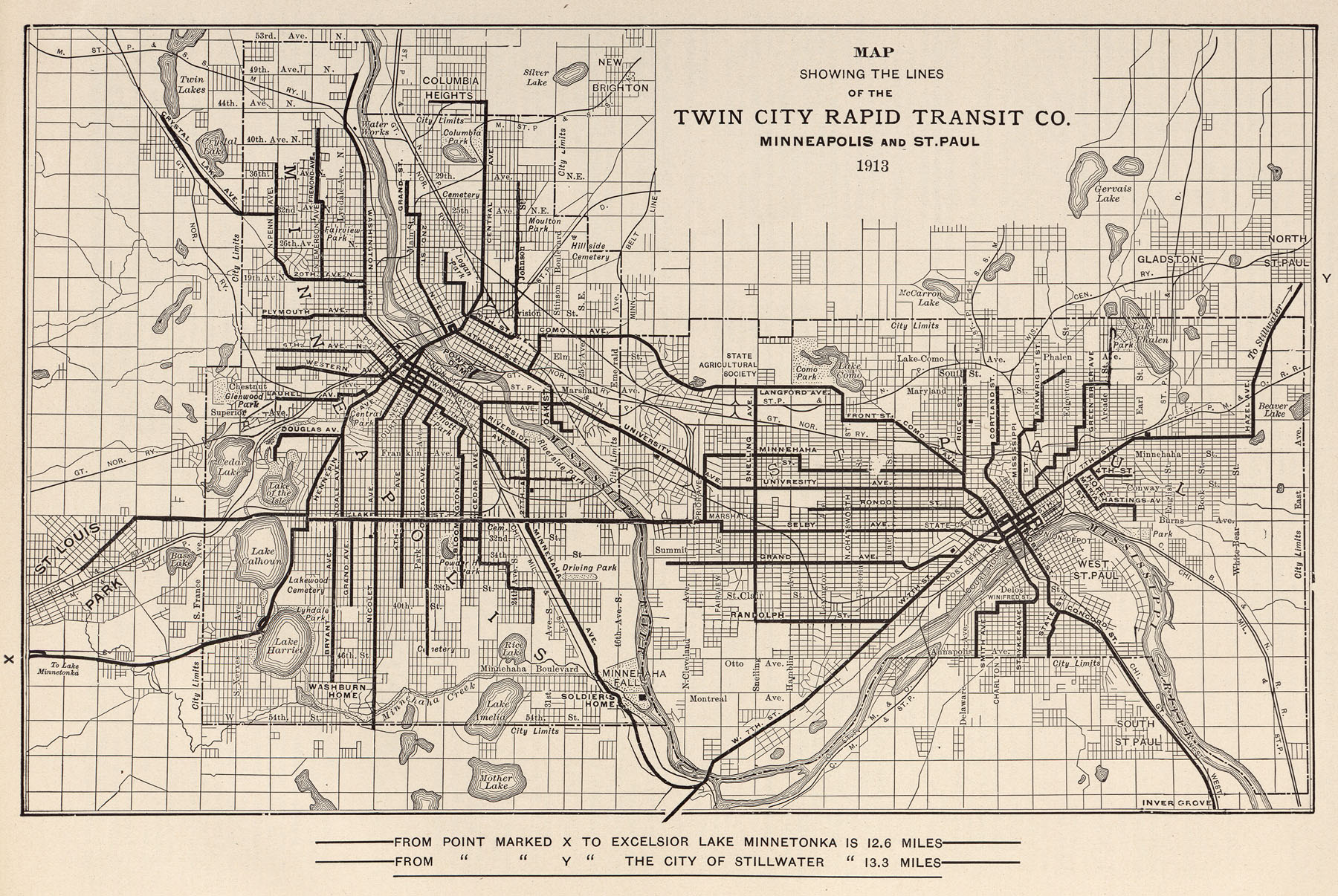
That's a old map from 1913 that shows the transit routes around Minneapolis and St. Paul. Why it's interesting is in North it shows just a few fingers of housing that were there at the time and Victory Parkway was just in the planning stages - wikipedia.org/wiki/Victory_Memorial_Parkway
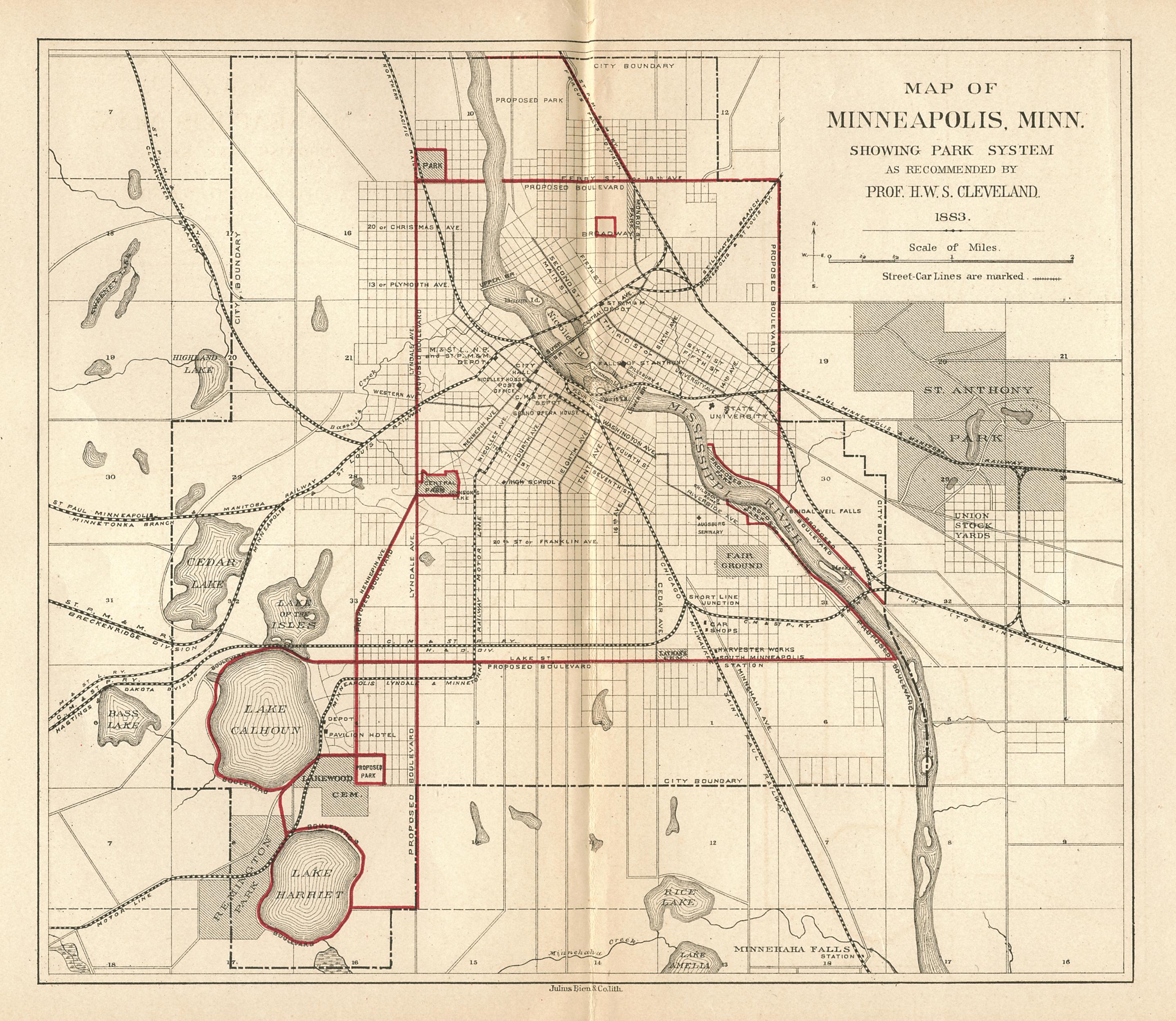
Also, that this map, although a proposed park map, shows that as of 1883 most North of Broadway wasn't there:
This is what makes North really unique as far as housing and community. We run the range of the old grand upper middle and middle class (the workers were more over in NE) Victorian homes to the bungalows and arts and craft periods.
Or maybe I'm looking into too much on a day off, and thinking about it too much after meeting with some non profit housing partners that I will work with through HNC.
No comments:
Post a Comment